FAMOUS DESTINATIONS
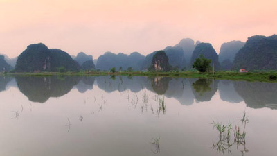
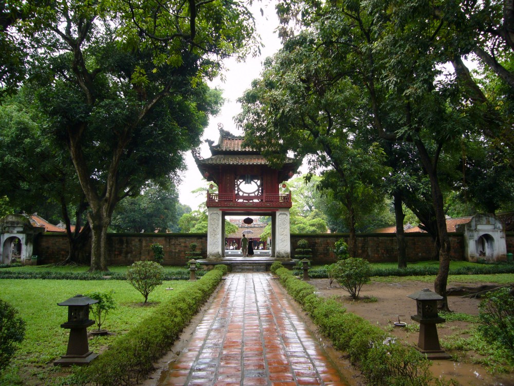
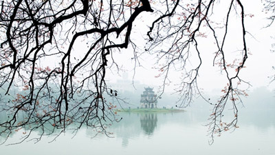
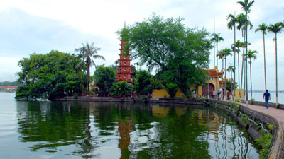
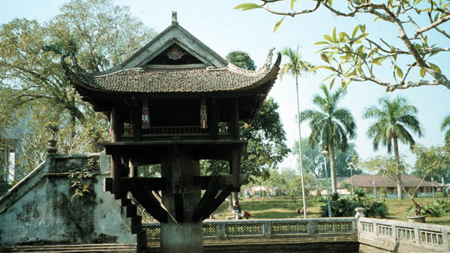
HA NOI
| Area: |
2,095.6 sq. km. |
| Population: |
7,681.7 thousand habitants (2012) |
| Administrative divisions: |
- 12 urban districts: Hoan Kiem, Ba Dinh, Dong Da, Hai Ba Trung, Tay Ho, Thanh Xuan, Cau Giay, Long Bien, Hoang Mai, Ha Dong, Nam Tu Liem, Bac Tu Liem.
- 1 town: Son Tay
- 17 rural districts: Dong Anh, Soc Son, Thanh Tri, Gia Lam (Ha Noi); Ba Vi, Chuong My, Dan Phuong, Hoai Duc, My Duc, Phu Xuyen, Phuc Tho, Quoc Oai, Thach That, Thanh Oai. Thuong Tin, Ung Hoa (former Ha Tay province) and Me Linh (a former district of Vinh Phuc province).
|
| Ethnic groups: |
Viet (Kinh), Hoa, Muong, Tay, Dao… |
Ha Noi is the capital of the Socialist Republic of Viet Nam, the center of culture, politics, economy and trade of the whole country.
Geography
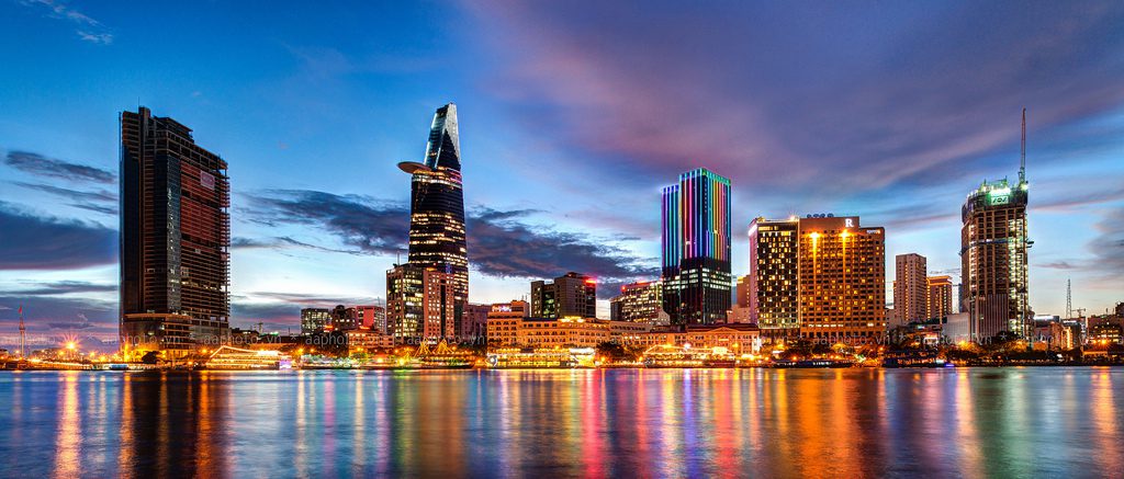
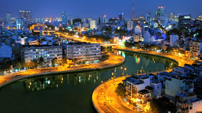
In the core of the Mekong Delta, Ho Chi Minh City, formerly known as Saigon, is second the most important in Viet Nam after Ha Noi. It is not only a commercial center but also a scientific, technological, industrial and tourist center. The city is bathed by many rivers, arroyos and canals, the biggest river being the Saigon River. The Port of Saigon, established in 1862, is accessible to ships weighing up to 30,000 tons, a rare advantage for an inland river port.
Climate
The climate is generally hot and humid. There are two distinctive seasons: the rainy season, from May to November, and the dry season, from December to April. The annual average temperature is 270C. The hottest month is April and the lowest is December. It is warm all year.
History
Many centuries ago, Saigon was already a busy commercial center. Merchants from China, Japan and many European countries would sail upstream the Saigon River to reach the islet of Pho, a trading center. In the year of 1874, Cho Lon merged with Saigon, forming the largest city in the Indochina. It had been many times celebrated as the Pearl of the Far East. After the reunification of the country, the 6th National Assembly in its meeting of the 2nd of July, 1976, has officially rebaptized Saigon, Ho Chi Minh City. The history of city relates closely with the struggle for the independence and freedom of Vietnam.
Tourism
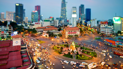
Today, Ho Chi Minh City is the big tourism center in Vietnam, attracting a large of visitors to Vietnam. Ho Chi Minh City has various attractions as Ho Chi Minh Museum, formerly known as Dragon House Wharf, Cu Chi Tunnels, system of museums, theatres, cultural houses… Recently, many tourist areas are invested such as Thanh Da, Binh Quoi Village, Dam Sen Park, Saigon Water Park, Suoi Tien, Ky Hoa…, which draw numerous tourists.
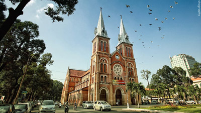
Despite its quite recent past, Ho Chi Minh City nevertheless possesses various beautiful buildings, displaying a characteristic combination of Vietnamese, Chinese and European cultures. These include Nha Rong (Dragon House Wharf), Quoc To Temple (National Ancestors Temple), Xa Tay (Municipal Office), Ho Chi Minh Municipal Theatre as well as many pagodas and churches (Vinh Nghiem, Giac Vien, Giac Lam, Phung Son pagodas…). After more than 300 years of development, Ho Chi Minh City presents many ancient architectural constructions, famous vestiges and renowned sights. It is remarkable for its harmonious blending of traditional national values with northern and western cultural features.
Transportation
Ho Chi Minh City is the main junction for trains, roads, water, and air transportation systems for domestic trips and for foreign destination.
- By Road:Ho Chi Minh City is 1,730km from Hanoi, 99km from Tay Ninh, 30km from Bien Hoa (Dong Nai), 70km from My Tho, 125km from Vung Tau, 168km from Can Tho, 308km from Dalat, and 375km from Buon Ma Thuot. The City has National Highway 13 which connects Vietnam with the rest of Indochina.
- By Train:Thong Nhat express train connects Ho Chi Minh City and Hanoi, vie many provinces in Vietnam.
- By Air:Tan Son Nhat International Airport, 7km from center of city, is the biggest airport with many domestic and international routes. There are flights from Hanoi and Danang to Ho Chi Minh City and between the City to many regions as well a lot of countries on over the world.
HO CHI MINH
| Area: |
2,095.6 sq. km. |
| Population: |
7,681.7 thousand habitants (2012) |
| Administrative divisions: |
- Districts: District 1, District 2, District 3, District 4, District 5, District 6, District 7, District 8, District 9, District 10, District 11, District 12, Tan Binh, Binh Thanh, Phu Nhuan, Thu Duc, Go Vap, Binh Tan,Tan Phu.
- Rural districts: Nha Be, Can Gio Hoc Mon, Cu Chi Binh Chanh.
|
| Ethnic groups: |
Viet (Kinh), Hoa, Khmer, Cham… |
Geography
In the core of the Mekong Delta, Ho Chi Minh City, formerly known as Saigon, is second the most important in Viet Nam after Ha Noi. It is not only a commercial center but also a scientific, technological, industrial and tourist center. The city is bathed by many rivers, arroyos and canals, the biggest river being the Saigon River. The Port of Saigon, established in 1862, is accessible to ships weighing up to 30,000 tons, a rare advantage for an inland river port.
Climate
The climate is generally hot and humid. There are two distinctive seasons: the rainy season, from May to November, and the dry season, from December to April. The annual average temperature is 270C. The hottest month is April and the lowest is December. It is warm all year.
History
Many centuries ago, Saigon was already a busy commercial center. Merchants from China, Japan and many European countries would sail upstream the Saigon River to reach the islet of Pho, a trading center. In the year of 1874, Cho Lon merged with Saigon, forming the largest city in the Indochina. It had been many times celebrated as the Pearl of the Far East. After the reunification of the country, the 6th National Assembly in its meeting of the 2nd of July, 1976, has officially rebaptized Saigon, Ho Chi Minh City. The history of city relates closely with the struggle for the independence and freedom of Vietnam.
Tourism
Today, Ho Chi Minh City is the big tourism center in Vietnam, attracting a large of visitors to Vietnam. Ho Chi Minh City has various attractions as Ho Chi Minh Museum, formerly known as Dragon House Wharf, Cu Chi Tunnels, system of museums, theatres, cultural houses… Recently, many tourist areas are invested such as Thanh Da, Binh Quoi Village, Dam Sen Park, Saigon Water Park, Suoi Tien, Ky Hoa…, which draw numerous tourists.
Despite its quite recent past, Ho Chi Minh City nevertheless possesses various beautiful buildings, displaying a characteristic combination of Vietnamese, Chinese and European cultures. These include Nha Rong (Dragon House Wharf), Quoc To Temple (National Ancestors Temple), Xa Tay (Municipal Office), Ho Chi Minh Municipal Theatre as well as many pagodas and churches (Vinh Nghiem, Giac Vien, Giac Lam, Phung Son pagodas…). After more than 300 years of development, Ho Chi Minh City presents many ancient architectural constructions, famous vestiges and renowned sights. It is remarkable for its harmonious blending of traditional national values with northern and western cultural features
Transportation
Ho Chi Minh City is the main junction for trains, roads, water, and air transportation systems for domestic trips and for foreign destination.
- By Road:Ho Chi Minh City is 1,730km from Hanoi, 99km from Tay Ninh, 30km from Bien Hoa (Dong Nai), 70km from My Tho, 125km from Vung Tau, 168km from Can Tho, 308km from Dalat, and 375km from Buon Ma Thuot. The City has National Highway 13 which connects Vietnam with the rest of Indochina.
- By Train:Thong Nhat express train connects Ho Chi Minh City and Hanoi, vie many provinces in Vietnam.
- By Air:Tan Son Nhat International Airport, 7km from center of city, is the biggest airport with many domestic and international routes. There are flights from Hanoi and Danang to Ho Chi Minh City and between the City to many regions as well a lot of countries on over the world.
HUE
| Area: |
70.99 sq. km |
| Population: |
339.8 thousand habitants (2009) |
| Administrative divisions: |
- Wards:Phu Nhuan, An Cuu, Truong An, Phuoc Vinh, Vinh Ninh, Phu Hoi, Xuan Phu, Vy Da, Tay Loc, Thuan Loc, Thuan Thanh, Thuan Hoa, Kim Long, Phu Hoa, Phu Cat, Phu Hiep, Phu Hau, Phu Binh, Phu Thuan and Phuong Duc, Huong So, An Hoa, An Dong, An Tay, Huong Long, Thuy Xuan, Thuy Bieu.
|
| Ethnic groups: |
Viet (Kinh) |
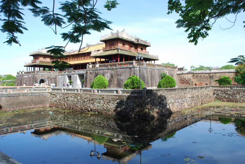
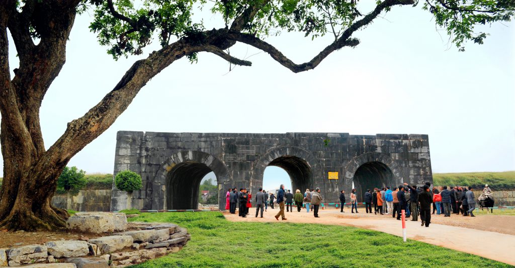
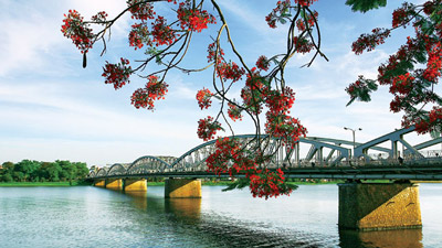
Hue City is one of places which have many cultural heritage. Up to now, there is no place like Hue remaining a lot of originally historical vestiges as in this ancient Capital City.
On the northern bank of Perfume River has relics consisting of palaces, which were constructed as arc defensive ramparts with 11km length. This valuable construction includes more than 100 architectural works which were extremely reflected the life of Emperors and mandarins under reign of Nguyen. Situated in the middle of hills on the southern bank of PerfumeRiver are very beautiful tombs of Kings Nguyen. Among these tombs are the four famous ones with the name and the arrangements of the tomb reflected each Emperor’s points of view, personality and tastes. This is majestic Gia Long Tomb, imposing Minh Mang Tomb, poetic Tu Duc Tomb and magnificent Khai Dinh Tomb.
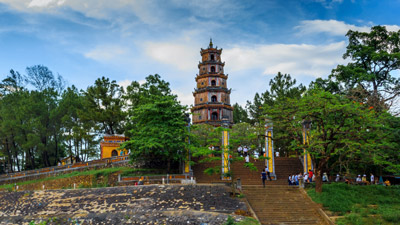
Hue is also an important center of Buddhism. In Hue and its surrounding still exist tens of pagodas constructed more 300 years ago, and a hundred of temples and pagodas built in the early century. Besides, Hue is a place where the royal music is originated, and a place with traditional famous dishes and sophisticated handicraft.
As a unique city of Vietnam still remains its form of City under Middle Age and the constructions of monarchic, Hue has become a big and invaluable museum. Therefore, vestiges in Hue ancient capital have been classified by the government as a very precious property and on December 1993 Hue has been recognized as a World Cultural Heritage Site by UNESCO.
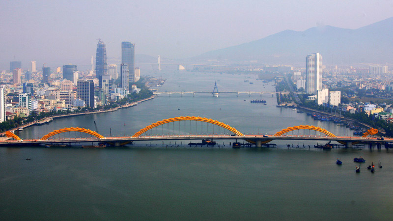
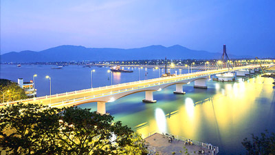
DA NANG
| Area: |
1,285.4 sq. km. |
| Population: |
973.8 thousand habitants (2012) |
| Administrative divisions: |
- Districts: Hai Chau, Thanh Khe, Son Tra, Ngu Hanh Son, Lien Chieu, Cam Le
- Rural districts: Hoa Vang, Hoang Sa
|
| Ethnic groups: |
Viet (Kinh), Hoa, Co Tu, Tay… |
Geography
Da Nang City is located in middle of Central Viet Nam, between Ha Noi and Ho Chi Minh City, separated from Laos by the western Truong Son Mountains. It is surrounded by Thua Thien-Hue along the northern border and Quang Nam on the southern border. It is embraced by the East Sea with 150km of seacoast.
Topography is rather complex. The south is impressive Hai Van Pass with Mang Mountain 1,708m, Ba Na Mountain 1,487m. The east is Son Tra Peninsula, an ideal site of yellow sand beaches, historical remains, and rare bird and animal species. The south is Ngu Hanh Son (Marble Mountains). The seashore is Hoang Sa archipelago with a large fishery.
Climate
Da Nang is located in the zone of typical tropical monsoon, temperate and equable climate. The city’s weather bears the combination of the north and the south climate characters with the inclination to the former. There are two seasons: the wet from August to December and the dry season from January to July, cold waves are occasional but they are of average and short lasting. Average humidity is 83.4%.
Average temperature is about 260C, the highest is 28-300C in June, July, August, the lowest is 18-230C in December, January, February. In Ba Na Mountain, the temperature is 200C. Average rainfall is 2,505mm per year that concentrates during October and November.
Tourism
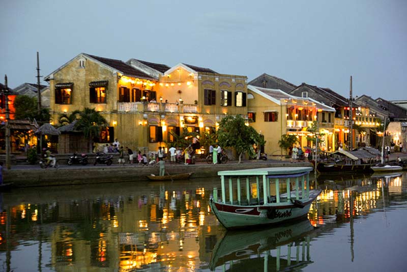
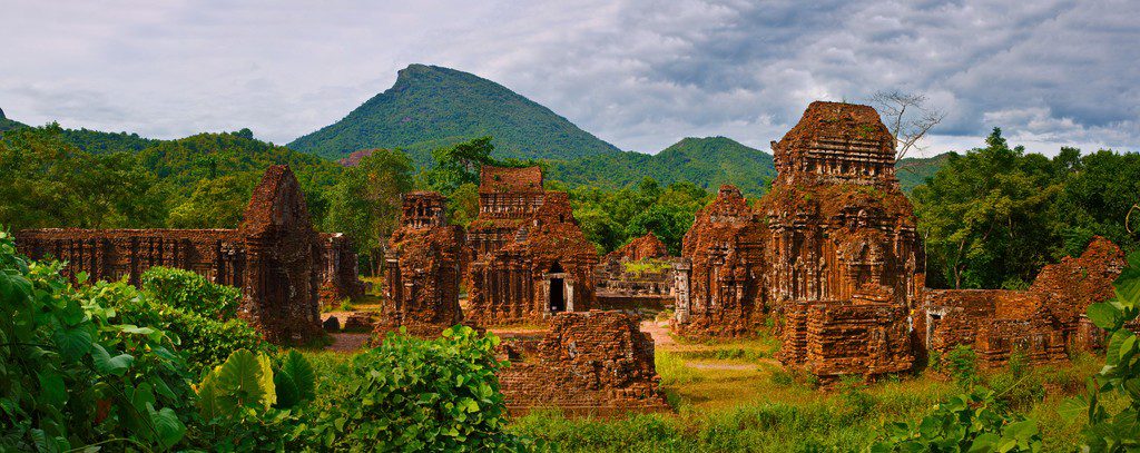
Da Nang is an ancient land, closely related with the Sa Huynh cultural traditions. Many imposing, palaces, towers, temples, citadels and ramparts, the vestiges from 1st to 13th are still to be seen in Cham Museum
Da Nang has other various interesting attractions as Ba Na Tourist Resort, Ngu Hanh Son (Marble Mountains) as well as the Linh Ung Pagoda, Han River, and My An, Non Nuoc beaches, stretching on dozens of kilometers…
Transportation
- By Road:Da Nang is 108km from Hue, 130km from Quang Ngai, 763km from Ha Noi, and 947km from Ho Chi Minh City.
- By Air:The Da Nang International Airport is 2.5km south-west of the city center. There are domestic flights to some cities. There are direct flight from Bangkok, Hong Kong, Siem Riep, Taipei and Singapore to Da Nang City by Vietnam Airlines, PB Air, Siem Riep Air way, Far Transportasion and Sil Airway.
- By Train:Thong Nhat Express train, which connects Ha Noi and Ho Chi Minh City, stop in Da Nang
- By Water:There are marine routes to international and domestic ports. Tien Sa and Han River ports are located in a very wonderful position
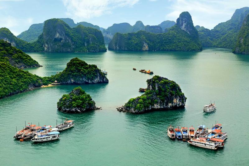
HA LONG
| Area: |
271.5 sq. km |
| Population: |
215,915 habitants (year 2009) |
| Administrative divisions: |
- Wards: Ha Khanh, Ha Lam, Ha Trung, Ha Phong, Ha Tu, Hong Hai, Cao Thang, Cao Xanh, Yet Kieu, Tran Hung Dao, Bach Dang, Hon Gai, Bai Chay, Hong Ha, Ha Khau, Gieng Day, Hung Thang, Tuan Chau, Viet Hung, Dai Yen.
|
| Ethnic groups: |
Mainly the Viet (or Kinh) |
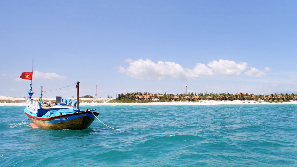
Ha Long City, formerly the Hon Gai Town, is the cultural, economic and political centre of Quang Ninh Province. It borders Cam Pha City to the east, the Quang Yen Town to the west, the Hoanh Bo District to the north and Ha Long Bay to the south with the coastline of 20km.
The city is divided into two parts: East Ha Long and West Ha Long. The eastern part is an industrial zone where most of the province’s official buildings are also concentrated. The western part, also called Bai Chay, is the animated tourism zone.
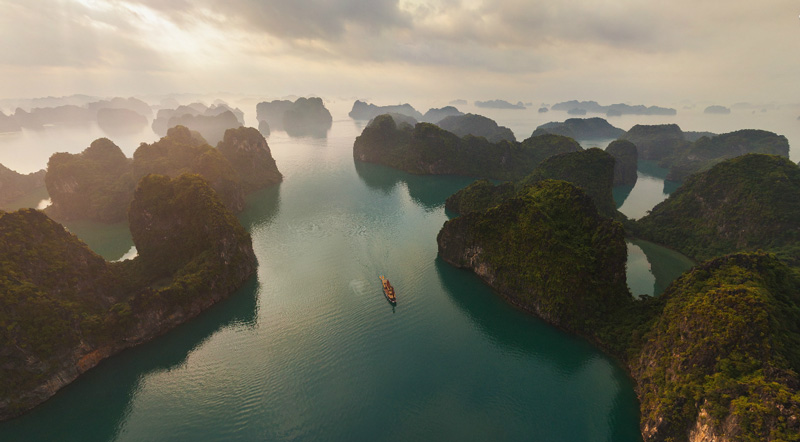
Ha Long’s population are most having emigrated from other places to settle here. Ha Long Bay is famous internationally, and is recognized as a World Heritage by UNESCO for its thousands of natural islands. Also in the city, there are temples, pagodas and historical relics.In addition to the most active branch of tourism, there are other economic activities such as: trade, seaport, coal, marine products and the production of construction materials
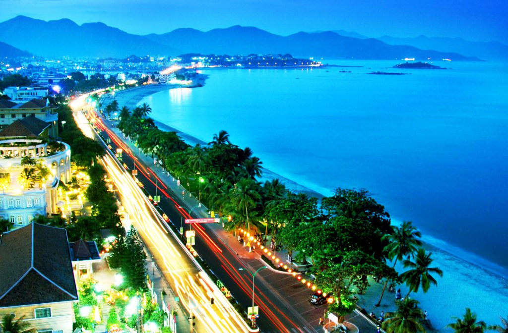
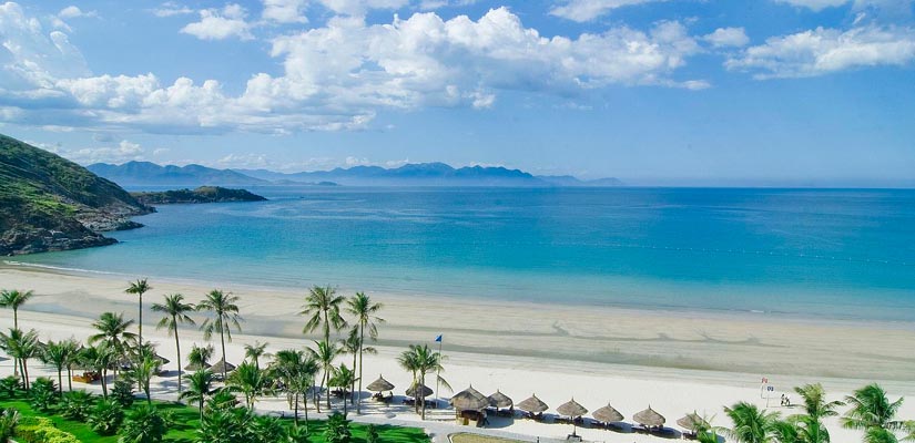
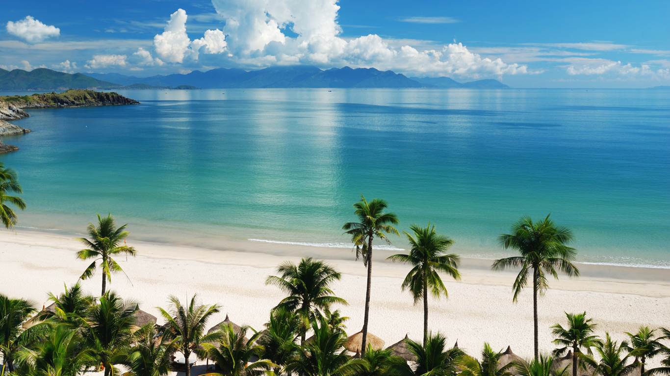
NHA TRANG
| Area: |
251 sq. km |
| Population: |
362 thousand people (2008) |
| Administrative divisions: |
- Wards: Vinh Hoa, Vinh Hai, Vinh Phuoc, Vinh Tho, Ngoc Hiep, Van Thang, Phuong Son, Xuong Huan, Van Thanh, Phuong Sai, Phuoc Tan, Phuoc Tien, Phuoc Hai, Phuoc Long, Loc Tho, Phuoc Hoa, Tan Lap, Vinh Nguyen, Vinh Truong.
- Communes: Vinh Luong, Vinh Phuong, Vinh Ngoc, Vinh Thanh, Vinh Hiep, Vinh Trung, Vinh Thai, Phuoc Dong.
|
| Ethnic groups: |
Mainly the Viet (or Kinh) |
The coastal city of Nha Trang in Khanh Hoa province, Central Viet Nam, lies on the trans-Vietnam highway, 1,278km from Ha Noi, and 448km from Ho Chi Minh City. Nha Trang is endowed by nature with deep, quiet and warm waters all the year round, surrounded by archipelagoes, islands, mountains and white sand beaches – a wonderful and attractive tourist resort.
To the north of Nha Trang stands the Chong mount which looks like a wide open hand over the sea. Far offshore, the Yen (Swallow) Island appears with lush green colours where salangane nests have been harvested for years to make the traditional “bird’s nest” tonic and food.
The 7km white sand beach of Nha Trang is often called Vietnam’s Mediterranean Area, considered one of the jewel along Vietnam’s long stretching coast line. Nha Trang is sunny all year round, with an average temperature of 23°C due to northern winds.
The rainfall is less than anywhere else in the country and the area is not threatened by storms since it is protected by the Truong Son Mountains and Ca Pass. From Ca Pass, one can see Ro Bay (Vung Ro), Hon Do…
Hon Tre Island is 36km² and belongs to a group of islands located southwest of Nha Trang. It takes two hours to reach Hon Tre Island by rowboat and only 20 minutes by ferry.
Nha Trang benefits from topographical advantages of the sea, islands, mountains, and deltas. West of Nha Trang, there are endless mountain ranges where a wide variety of animals and birds live.
Nha Trang has many specialties. Especially, bird’s nest soup, or swallow’s nest soup is very famous in Nha Trang and round Vietnam. The magnificent coral seabed in Nha Trang makes it ideal for scubadiving and snorkeling.
Nha Trang Bay is recognised as one of 29 most beautiful bays in the world.
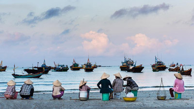
MUI NE BEACH
Location: Ham Tien Ward, Phan Thiet City, Binh Thuan Province, about 220km from Ho Chi Minh City centre.
Characteristics: It is a fishing village as well as an attractive tourist site in Binh Thuan Province.
From Ho Chi Minh City, taking National Highway No.1A for 198km to Phan Thiet City and then taking Route 706 for another 22km, tourists will reach Mui Ne Beach.
Mui Ne has long been considered the “Hawaii” of Vietnam. Its features are immense sand dunes meandering through kilometers of red, yellow and white, shady roads under coconut trees, beautiful rows of palm trees and cliffs battered by the waves of the sea. The beach is shallow and sloped, the water is clean and blue and the sun rarely hides behind clouds. The typical scenery of Mui Ne lies in the moving lines of golden sand caused by the wind and when they are seen from afar they look like moving waves. The scenery looks more fascinating at dawn, when young Cham girls in green dresses go to work. That’s why no photographer fails to visit this area.
Mui Ne is an ideal place for rest and relaxation. Mui Ne has known as “resort capital” of Vietnam with many resorts along the seacoast. Tourists can swim in the blue water of the sea, slip on the sand dunes, relax in swimming pool of resorts or kiteboard and windsurf. The beach has the best conditions for water sports because it has strongest and most consistent cross-onshore winds in Asia and the lowest rainfall in Vietnam. There are currently about a dozen kiteboarding centers in Mui Ne and the competition is fierce. In addition, tourists can go shopping at the Mui Ne Market for types of fresh sea-food and local specialties.
Mui Ne’s surroundings has some beautiful sceneries such as Suoi Tien (Fairy Spring) – deep and red canyons parted by twisting streams and echoed by the sounds of tropical birds; Ong Hoang Building and Poshanu Cham Tower Complex.
PHU QUOC DISTRICT
Located in the Thailand Gulf, Phu Quoc (Kien Giang Province) is the largest island district in Viet Nam. The capital of the island district is Duong Dong Town, about 120km from Rach Gia City and 45km from Ha Tien Town.
Phu Quoc Island District includes 36 islands of different sizes, of which Phu Quoc Island is the largest one with the area of 573km2. The island has tropical monsoon climate characterized by 2 distinct seasons, rainy season (June to November) and dry season (December to May). The annual average rainfall is 2,879mm.
Phu Quoc is also called “emerald island” due to its natural treasures and tourism potentials. The island has many beautiful beaches as Truong Beach, Khem Beach, Sao Beach… Especially, Phu Quoc National Park with the area of 31,422ha has a diversified ecosystem of 929 species of flora, 89 species of hard coral, 19 species of soft coral, 62 species of seaweed…
Phu Quoc has harbors of An Thoi and Hon Thom where ships anchor and exchange goods. Phu Quoc Island is also home to many historical sites such as national hero Nguyen Trung Truc’s military base, Phu Quoc Prison…
The island is well known for its high-quality fish sauce. Phu Quoc fish sauce’s smell is particularly good since it is made from anchovy (ca com), with a high level of protein. Besides, Phu Quoc sea also has many precious types of seafood as prawns, mackerels, pomfrets, blue fishes…
The transportation system in the island is growing rapidly. The transport routes between mainland and the island by air and sea are very convenient for tourists. Especially, Phu Quoc International Airport has put into operation since 2 December 2012 to facilitate the arrival of international tourists attracted by the island’s beauty
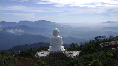
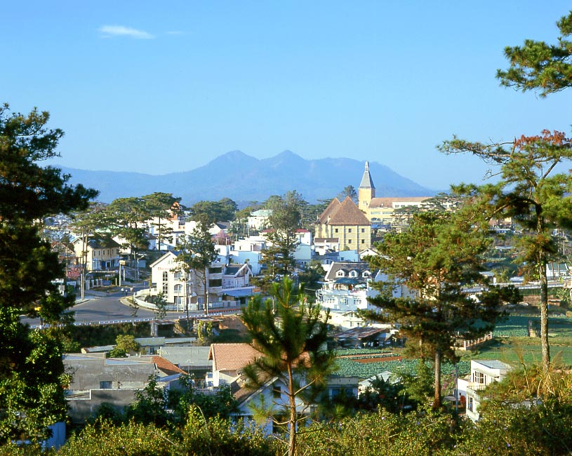
DA LAT
| Area: |
390.5 sq. km |
| Population: |
197 thousand habitants (2007) |
| Administrative divisions: |
- Wards: 1, 2, 3, 4, 5, 6, 7, 8, 9, 10, 11, 12
- Communes: Xuan Tho, Xuan Truong, Ta Nung, Tram Hanh
|
| Ethnic groups: |
M’nong, Ma, Co Ho… |
Da Lat, capital of Lam Dong Province, is located approximately 308km northeast of Ho Chi Minh City. At an elevation of 1,500m, Da Lat bears the look of an Old French city. It was founded in 1897 when Doctor Alexandre Yersin recommended that the area be developed as a resort town. Dalat has many natural and artificial lakes such as Ho Xuan Huong, Than Tho, Da Thien, and Tuyen Lam bordered by lines of pine trees, which are a well-known feature of Da Lat. A trip to Da Lat is not complete until one goes to the Da Lat Flower Gardens.
The temperate climate of Da Lat is suitable for flowers such as orchids, roses, lilies, and camellias. Nowadays, tourists not only limit themselves to Da Lat; they also visit the area of Langbian Highland and the ethnic minorities. Langbian Mountain’s highest peak at 2,165m is very tempting for climbers. From Lom Bieng Klo peak, one can see endless green mountains reflecting the silver rays of the sun. Many tours are organized in the area, including parachuting and climbing.
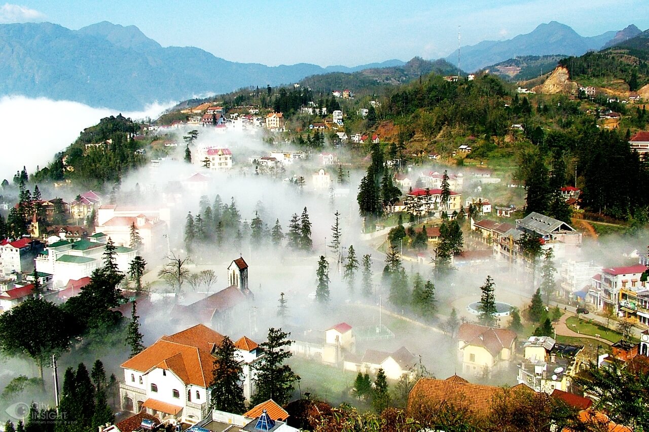
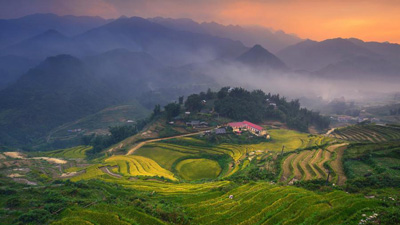
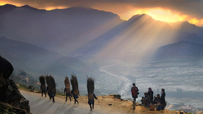
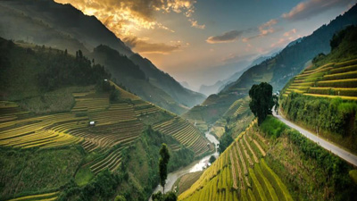
SAPA DISTRICT
| Area: |
678.6 sq. km |
| Population: |
52.5 thousand habitants(2007) |
| Administrative divisions: |
- Townlet: Sa Pa
- Communes: Ban Khoang, Ta Giang Phinh, Trung Chai, Ta Phin, Sa Pa, San Sa Ho, Ban Phung, Lao Chai, Hau Thao, Thanh Kim, Ta Van, Su Pan, Suoi Thau, Ban Ho, Thanh Phu, Nam Sai, Nam Cang.
|
| Ethnic groups: |
M’nong, Ma, Co Ho… |
Located 38km from Lao Cai City, Sa Pa is a mountainous district of Lao Cai Province. Sa Pa District is very well-known with Sa Pa Townlet, a beautiful and romantic resort.
At the height of 1,600m above sea level, the average temperature of the area is 15-18oC. It is cool in summer and cold in winter.
Visitor to Sa Pa in summer can feel the climate of four seasons in one day. In the morning and afternoon, it is cool like the weather of spring and autumn. At noon, it is as sunny and cloudless as the weather of summer. And it is cold in the evening. With no advance warning of a thunderstorm short and heavy rains may come at noon on any summer day. Subsequently, a rainbow appears, transforming Sa Pa into a magic land, which for years has been a constant source of poetic inspiration, lights up the whole region.
The best time to witness the scenic beauty of Sa Pa is in April and May. Before that period, the weather might be cold and foggy; after that period is the rainy season. In April and May, Sa Pa is blooming with flowers and green pastures. The clouds that settle in the valley in early morning quickly disappear into thin air.
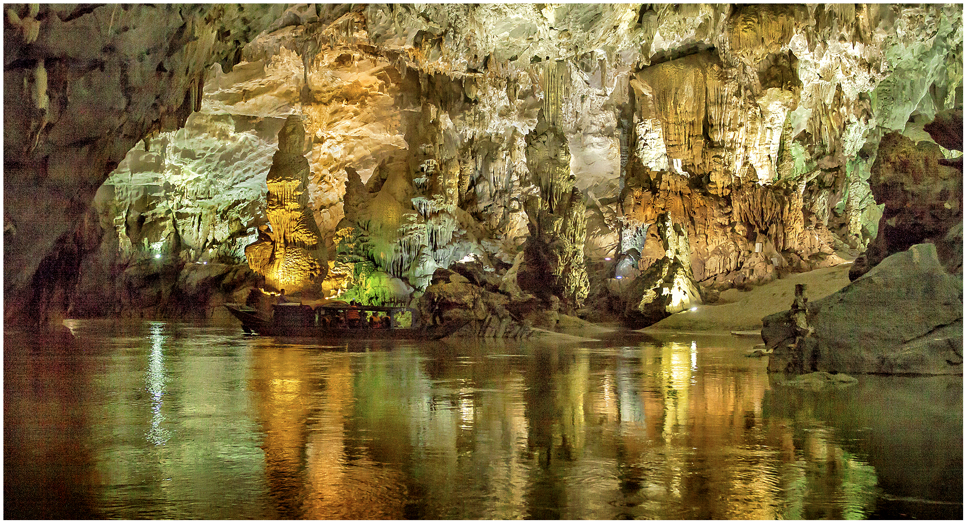
Sa Pa has many natural sites such as Ham Rong Mountain, Silver Waterfall, Rattan Bridge, Bamboo Forest and Ta Phin Cave. Sa Pa is also the starting point for many climbers and scientists who want to reach the top of Fansipan Mountain, the highest mountain in Vietnam at 3,143m. Hoang Lien Mountain Range is also called the Alps of the North Sea area since Fansipan Mountain is not only the highest peak in Vietnam, but also in the Indochina Peninsula. The pyramid-shaped mountain is covered with clouds all year round and temperatures often drop below zero, especially at high elevations.
The first thing you notice when approaching the resort town are some detached wooden mansions and villas perched on a hill top or hillside, behind thick pine forests and almost invisible on this foggy morning. Old and new villas with red roofs now appear and now disappear in the green rows of pomu trees, bringing the town the beauty of European towns.
Fresh and cool air in Sa Pa is an idea climate condition for growing temperate vegetables such as cabbage, chayote, precious medicinal herbs, and fruit trees such as plum, pear…
Sa Pa is home to various families of flowers of captivating colours, which can be found nowhere else in the country. When Tet, the Lunar New Year Festival, comes, the whole township of Sa Pa is filled with the pink colour of peach blossom brought from the vast forests of peach just outside the town. Sa Pa is regarded as the kingdom of orchids. Here, orchid lovers are even amazed by the choice, when trekking in the forest filled with several hundred kinds of orchids of brilliant colours and fantastic shapes, such as Orchid Princess, Orchid of My Fair Lady’s Shoe. Some orchids are named after lovely singing birds such as the canary, salangane’s nest, and more.
Sa Pa is most beautiful in spring. Apricot, plum and cherry flowers are splendidly beautiful. Markets are crowded and merry, and are especially attractive to visitors. Minority groups come here to exchange and trade goods and products. Market sessions are also a chance for locals to promenade and young men and women in colorful costumes to meet, date or seek sweethearts.
Visitors to Sa Pa will have opportunities to discover the unique customs of the local residents.